Col de Chamrousse
Streckendetails
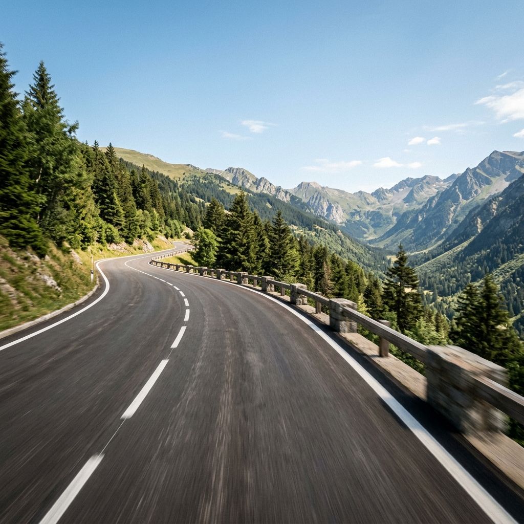
The Col de Chamrousse connects Vaulnaveys-le-Haut with Saint-Martin-d'Uriage and leads up to around 1800 meters. The 33-kilometre-long, continuously asphalted Pass road winds its way up the mountain with varying radii…
The Col de Chamrousse connects Vaulnaveys-le-Haut with Saint-Martin-d'Uriage and leads up to around 1800 meters. The 33-kilometre-long, continuously asphalted Pass road winds its way up the mountain with varying radii; flowing bends alternate with tighter Hairpins and short ramps with gradients of up to 21 percent that require a sensitive driver. The width of the road varies, sometimes with and sometimes without a continuous central reservation, and overtaking opportunities are limited - ideal for clean, anticipatory driving. The overall level of difficulty is medium (Difficulty level 3): Ambitious beginners with cornering experience will cope well, while experienced riders will enjoy the length and sporty profile; those new to the mountains should approach the steep sections with respect. Depending on your pace, you should allow just under an hour for the entire ascent.
As a regional Pass road with no supra-regional transit function, the Col de Chamrousse is mainly used to access the high altitudes above Uriage and to connect the valleys between Vaulnaveys-le-Haut and Saint-Martin-d'Uriage. The volume of traffic is usually moderate outside the peak travel times, but can increase significantly at sunny weekends and during the vacation season. During such periods, you can expect slower vehicles, occasional formations and oncoming traffic in the narrower sections; if you are looking for the quiet side of the Mountain pass, it is best to plan for off-peak times.
- Region Auvergne-Rhône-Alpes
Motorradtouren zu diesem Pass
Distanz
Wähle die Distanz deiner idealen Tour.
Hyper-personalisierte Touren für dich und deinen Stil.
Gestalte deine eigenen epischen Touren mit unserem intuitiven Routenplaner. Wähle Motorrad aus, gib Start-, Ziel- und Wegpunkte ein und lass dir deine Route berechnen.